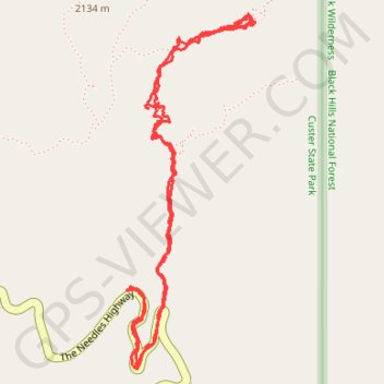
Cathedral Spires
Hike to Cathedral Spires in the Custer State Park. #Hike #Mountain #Nature #Forest #Park
- Distance: 4.9 Km
- Elevation gain: 243 m
- Maximum elevation: 2,042 m
- Elevation loss: 241 m
- Minimum elevation: 1,899 m
- Moving time: 1 h 50 m
- Moving speed: 2.7 Km/h
- Maximum speed: 12.3 Km/h
- Total time: 2 h 24 m
- Global speed: 2.0 Km/h
- Date: 14/08/2023
Interactive map
GPS track profile
About this GPS track
Name: Cathedral Spires GPS track, route, trail
Start: The Needles Highway, Custer County, South Dakota, United States (43.84230 -103.53665)
End: The Needles Highway, Custer County, South Dakota, United States (43.84228 -103.53672)
Coordinates: 43.83976 -103.53679 43.85087 -103.53112