D'Aguilar National Park - Mount Nebo - Cabbage Tree Creek
#MTB #Loop #Daguilar #Nebo #CabbageTree
- Distance: 43.7 Km
- Elevation gain: 1,569 m
- Maximum elevation: 549 m
- Elevation loss: 1,455 m
- Minimum elevation: 60 m
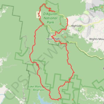
Interactive map
GPS track profile
About this GPS track
Name: D'Aguilar National Park - Mount Nebo - Cabbage Tree Creek GPS track, route, trail
Coordinates: -27.47438 152.74761 -27.35078 152.81184
Other GPS tracks
Click on a GPS track to view route, its statistics and profile.