Import a GPX file

Bear Creek Oasis

Hike from Cove Oasis to Bear Creek Oasis via the Bear Creek Trail in the Santa Rosa Wilderness. #Hike #Oasis #Nature #Desert #Mountain #Wilderness

  • Distance: 7.0 Km
  • Elevation gain: 649 m
  • Maximum elevation: 702 m
  • Elevation loss: 51 m
  • Minimum elevation: 103 m

Interactive map

GPS track profile

About this GPS track
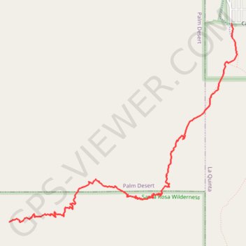
Other GPS tracks

Click on a GPS track to view route, its statistics and profile.

Boo Hoff Trail Loop

United States > California > Riverside County > La Quinta

Loop hike in the Santa Rosa Wilderness from the Cove Oasis via Boo Hoff Trail, Devil Canyon and Lake Cahuilla. #Hike #Loop #Mountain #Wilderness #Nature #Canyon #Lake

Distance: 20.0 Km • Elevation gain: 712 m • Maximum elevation: 577 m

Lake Cahuilla to Cove Oasis Loop

United States > California > Riverside County > La Quinta

Loop hike from Lake Cahuilla Park to Cove Oasis via Boo Hoff Trail in the Santa Rosa Wilderness. #Hike #Loop #Lake #Nature #Mountain #Wilderness #Desert

Distance: 17.4 Km • Elevation gain: 673 m • Maximum elevation: 577 m