Horseshoe Bend Viewpoint (Colorado River)
Interactive map
GPS track profile
About this GPS track
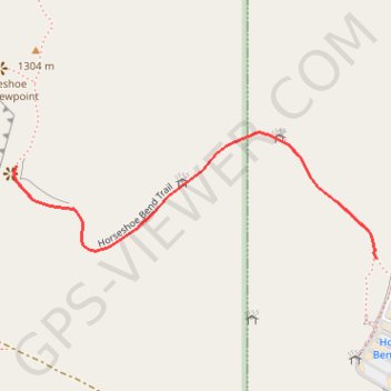
Name: Horseshoe Bend Viewpoint (Colorado River) GPS track, route, trail
Start: Horseshoe Bend Trail, Page, Coconino County, Arizona, United States (36.87777 -111.50320)
End: Horseshoe Bend Trail, Page, Coconino County, Arizona, United States (36.87928 -111.51053)
Coordinates: 36.87777 -111.51057 36.87983 -111.50320
Other GPS tracks
Click on a GPS track to view route, its statistics and profile.