Benoîtville (50340)
Interactive map
GPS track profile
About this GPS track
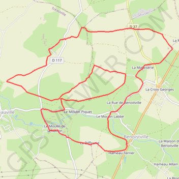
Name: Benoîtville (50340) GPS track, route, trail
Coordinates: 49.52523 -1.81144 49.54466 -1.77141
Other GPS tracks
Click on a GPS track to view route, its statistics and profile.
Tour d'Europe
France > Bretagne > Finistère > Concarneau > Landan Creis
Distance: 7,132.9 Km • Elevation gain: 44,603 m • Maximum elevation: 2,433 m
GR 223 Tour du Cotentin (2021)
France > Normandie > Eure > Berville-sur-Mer
Randonnée en Normandie sur le GR 223 autour du Cotentin à travers l'Eure, le Calvados et la Manche de Berville-sur-Mer au Mont-Saint-Michel.
Distance: 650.7 Km • Elevation gain: 6,685 m • Maximum elevation: 149 m
Sentier Cotentin - Cherbourg vers Mont-Saint-Michel
France > Normandie > Manche > La Hague > Urville-Nacqueville > La Rivière
Distance: 231.7 Km • Elevation gain: 2,584 m • Maximum elevation: 128 m
GR223 - Cherbourg à Coutances
France > Normandie > Manche > Cherbourg-en-Cotentin
Randonnée entre Cherbourg-Octeville et Coutances. #Randonnée
Distance: 201.4 Km • Elevation gain: 2,106 m • Maximum elevation: 138 m
RAF 2022 / 2600 n1 News
France > Hauts-de-France > Pas-de-Calais > Le Touquet-Paris-Plage
Distance: 2,594.8 Km • Elevation gain: 39,725 m • Maximum elevation: 2,766 m
Randonnée de Cherbourg à Portbail par le GR 223
France > Normandie > Manche > Cherbourg-en-Cotentin
Randonnée sur sentier du littoral à travers la Manche de Cherbourg à Portbail via Equeurdreville, Urville-Nacqueville, Hameau aux Fèvres (Greville-Hague), Digulleville, Herqueville, Biville, Les Pieux, Surtainville, Baubigny, Barneville-Carteret et Barneville-Carteret. #Randonnée #GR223 #Normandie #Manche #Mer #Nature
Distance: 110.6 Km • Elevation gain: 2,100 m • Maximum elevation: 131 m
Etape 1 du Raid de l'Archange
France > Normandie > Manche > La Hague > Beaumont-Hague > Le Hameau Sauvage
De La Hague à Carteret
Distance: 73.2 Km • Elevation gain: 1,771 m • Maximum elevation: 174 m
Etape 2 du Raid de l'Archange
France > Normandie > Manche > Carteret > Le Valnotte
De Carteret à Lestre
Distance: 79.8 Km • Elevation gain: 631 m • Maximum elevation: 114 m
1 - RDC 2024 VTT 57 km
France > Normandie > Manche > Flamanville > Marcanville
RDC 2024 VTT 57 km
Distance: 57.5 Km • Elevation gain: 977 m • Maximum elevation: 140 m
1 - RDC 2024 VTT 38 km
France > Normandie > Manche > Flamanville > Marcanville
RDC 2024 VTT 38 km
Distance: 37.7 Km • Elevation gain: 630 m • Maximum elevation: 129 m
1 - RDC 2024 VTT 27 km
France > Normandie > Manche > Flamanville > Marcanville
RDC 2024 VTT 27km
Distance: 27.5 Km • Elevation gain: 440 m • Maximum elevation: 96 m
Itinéraire de Nemours à Nemours
France > Centre-Val de Loire > Loiret > Bromeilles > Bainvilliers
Distance: 1,576.4 Km • Elevation gain: 8,536 m • Maximum elevation: 238 m
GR22 - De Cherbourg à Flamanville
France > Normandie > Manche > Cherbourg-en-Cotentin
Randonnée entre Cherbourg-Octeville et Flamanville. #Randonnée
Distance: 70.2 Km • Elevation gain: 1,477 m • Maximum elevation: 131 m
Rando cap de la Hague
France > Normandie > Manche > La Hague > Urville-Nacqueville > La Rivière
Randonnée entre Urville-Nacqueville et Baubigny. #Randonnée
Distance: 79.8 Km • Elevation gain: 1,378 m • Maximum elevation: 130 m
GR223 De Tourlaville à Portbail (Manche)
France > Normandie > Manche > Cherbourg-en-Cotentin
Randonnée entre Cherbourg-Octeville et Portbail. #Randonnée
Distance: 110.2 Km • Elevation gain: 2,026 m • Maximum elevation: 131 m
Flamanville (Rando des caps 2022) 56km
France > Normandie > Manche > Flamanville > Marcanville
Distance: 56.7 Km • Elevation gain: 979 m • Maximum elevation: 141 m
Les chemins de Saint-Michel - Cherbourg - Lessay
France > Normandie > Manche > Cherbourg-en-Cotentin
Randonnée entre Cherbourg-Octeville et Lessay. #Randonnée
Distance: 90.9 Km • Elevation gain: 788 m • Maximum elevation: 164 m
Tous les coins du Cotentin-12150732
France > Normandie > Manche > Saint-Floxel
Distance: 317.9 Km • Elevation gain: 3,204 m • Maximum elevation: 168 m
RdA 2022 E1
France > Normandie > Manche > La Hague > Beaumont-Hague > Le Hameau Sauvage
Distance: 73.5 Km • Elevation gain: 1,757 m • Maximum elevation: 175 m
RdA 2022 E3
France > Normandie > Manche > Le Havre de Quinéville > Les Roques
Distance: 103.6 Km • Elevation gain: 1,251 m • Maximum elevation: 166 m
La tollevataise 2019
France > Normandie > Manche > Tollevast > La Tourelle
Distance: 51.4 Km • Elevation gain: 821 m • Maximum elevation: 150 m
Siouville-Hague (50340)
France > Normandie > Manche > Siouville-Hague > Clairefontaine
Distance: 11.3 Km • Elevation gain: 187 m • Maximum elevation: 100 m
Cherbourg Carteret jour 4
France > Normandie > Manche > Flamanville > La Coquaise
Randonnée entre Flamanville et Barneville-Carteret. #Randonnée
Distance: 30.7 Km • Elevation gain: 500 m • Maximum elevation: 83 m