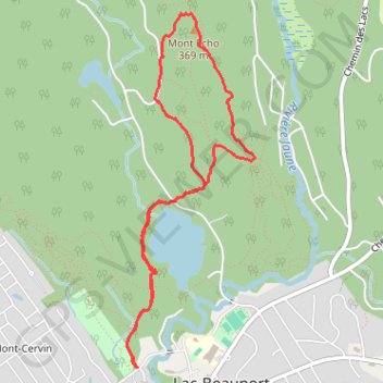
Randonnée pédestre. En boucle. #Randonnée #Boucle
Name: Mont Écho GPS track, route, trail
Start: 75, Chemin du Brûlé, Mont-Cervin, Lac-Beauport, La Jacques-Cartier, Capitale-Nationale, Québec, G3B 0W1, Canada (46.94527 -71.30377)
End: 75, Chemin du Brûlé, Mont-Cervin, Lac-Beauport, La Jacques-Cartier, Capitale-Nationale, Québec, G3B 0W1, Canada (46.94526 -71.30381)
Coordinates: 46.94526 -71.30461 46.96539 -71.29394