Ashridge Drovers
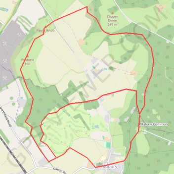
Interactive map
GPS track profile
About this GPS track
Name: Ashridge Drovers GPS track, route, trail
Coordinates: 51.80195 -0.62414 51.82734 -0.59020
Other GPS tracks
Click on a GPS track to view route, its statistics and profile.
Dockey Woods
United Kingdom > England > Buckinghamshire > Ivinghoe
Distance: 9.7 Km • Elevation gain: 150 m • Maximum elevation: 251 m